
Shaping Equitable Communities: How Zoning Creates Opportunity or Inequity
Introduction
The City of Richmond is over a year into Code Refresh, an initiative to “refresh” the City’s 50+ year old zoning code. Code Refresh presents an opportunity for the City to reenvision its future and prioritize sustainability, housing affordability, and racial justice in its zoning decisions. This is the first installment in our Climate-Smart Zoning series, which explores the relationship between zoning and the environment and provides recommendations for Code Refresh.
In this blog, we’ll discuss the impacts of zoning, how it relates to climate change and environmental justice, and introduce you to the Code Refresh process.
Why should I care about zoning? What impacts can it have?
Zoning shapes what can be built and where it can be built
Regardless of where you live, your life is shaped by laws that either allow or restrict certain types of development. Zoning and land use policies in our communities directly impact the development of our built environment (the physical things humans have built to support life, such as buildings, infrastructure, transportation networks, etc) and how land is used over time. Zoning dictates, for example, where commercial buildings – such as grocery stores – can be built. This, in turn, influences accessibility; if stores or basic services are located far from residential areas or require a car to get to, it is more difficult for residents to access them. If you live in a single-family neighborhood where every house has a yard, that’s because of zoning, too. Zoning regulations dictate the types of housing allowed in specific areas. In Richmond, many older neighborhoods in the East and West Ends are zoned as single-family. Scott’s Addition in the City’s West Side is zoned as Mixed-Use, meaning that both commercial and residential buildings (specifically multi-family housing) can be built there.
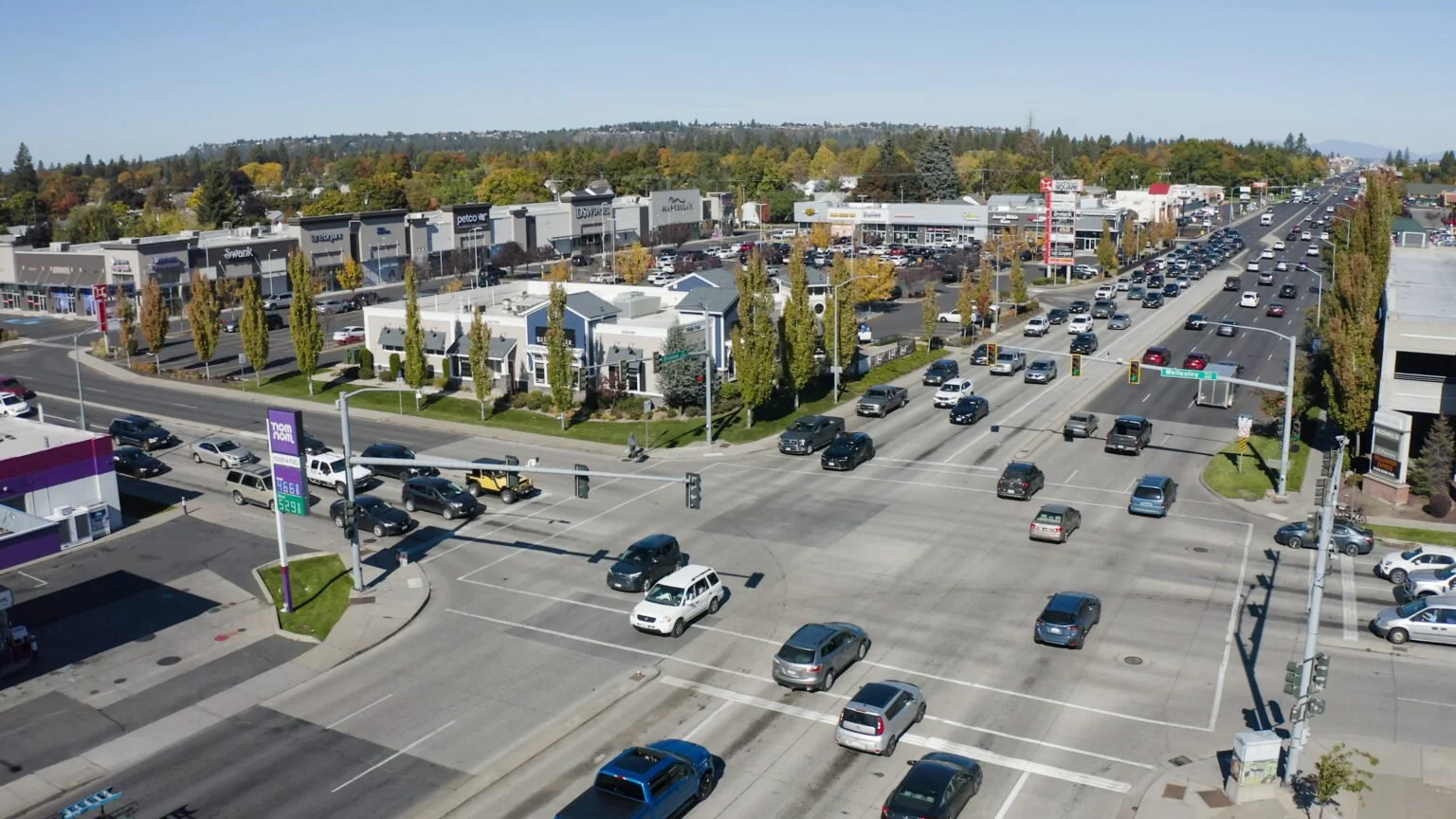
An intersection in Spokane, WA, where commercial areas are spread out, low-density, and mainly accessible by car. This is a common pattern in the US, due to zoning decisions. Source: Spokane Transit.
Zoning can create (or help repair) inequalities related to resources, housing, and environmental justice
Zoning is a powerful tool that can shape access to resources and services, housing choice and accessibility (whether an area has different types of housing available based on varying income levels or needs), neighborhood demographics, and exposure to environmental harms such as pollution. From the end of the Civil War through the 20th century, Richmond used a variety of discriminatory laws and tactics to shape where people live; from race-based zoning to racial covenants to redlining, these practices limited the physical and economic mobility of Black households in particular, who were restricted to certain areas and types of housing as a result.
Single-family zoning has long been used as a mechanism for segregating people along the lines of race and class; by only allowing certain types of housing to be built in an area (such as single-family homes, which are generally more expensive), those who cannot afford that housing type are priced out. Richmond’s 1942 zoning ordinance created single-family zoning that aligned with existing white neighborhoods, reinforcing decades of discriminatory policies. Neighborhoods that were majority-Black were largely zoned as multi-family, with many pushed closer to industrial areas. The ordinance effectively insulated white neighborhoods and shaped disparities in investment across Richmond, such as access to green space or transportation. Today, areas of Richmond subject to discriminatory planning and disinvestment - particularly the Southside and East End - have some of the highest rates of poverty and energy burden, and are impacted more severely by climate impacts such as urban heat islands and extreme heat (Figure 1).

Figure 1: Map of Richmond land surface temperatures across the City, overlaid with HOLC redlining map. Red and yellow lines indicate areas that were labeled as riskier investments and faced economic discrimination. Source: Groundwork RVA.
Discriminatory zoning laws and policies have also created environmental injustices by shaping the location of affordable, multi-unit housing and industry. Many of Richmond’s public housing courts, for example, are located near major highways and interstates. These roadways were built during the City’s period of urban renewal, in which areas designated as “slums” were cleared to build private and public infrastructure, leading to significant displacement of Black residents. Additionally, the majority of the City’s industrial areas are located in the Southside, which has the highest percentage of Black and low-income residents in Richmond.
What does zoning have to do with climate change?
In the United States, many metro areas are characterized by urban sprawl, which refers to rapid and unchecked development near cities, often characterized by single-family homes and reliance on private vehicles. Single-family homes consume more energy than any other building type (per unit), producing more emissions per household. Increased density can support more efficient land use and decreased energy consumption. Urban sprawl also increases reliance on cars, since homes are often in neighborhoods separate from schools, businesses, and essential services, including public transit.
Urban sprawl also impacts the commercial and development sectors by decentralizing services, leading to less efficient land use and reduced accessibility. Zoning regulations can influence the size, design, and proximity of commercial buildings. These factors, among others, shape operational patterns and energy consumption. If businesses are spread out or isolated, for example, trucks and commercial vehicles are required to travel farther distances to deliver goods and services, resulting in more pollution. Since urban sprawl spreads development across a larger area, this requires more infrastructure (gas, water, waste) to support these operations, increasing costs for municipalities.

Richmond’s bus rapid transit line, the Pulse. (Sarah Vogelsong / Virginia Mercury)
What are some examples of climate-informed zoning decisions?
Urging our local decision-makers to prioritize climate-smart zoning laws can transform and improve the quality of life for residents while also working towards our climate goals. For example, zoning laws that encourage density, mixed-use neighborhoods (where housing and businesses/services are close together), and transit-oriented development (encouraging development along or near transit networks) reduce reliance on motor vehicles and increase energy efficiency. More specific examples of climate-smart zoning include:
Disallowing future development in floodplains or areas vulnerable to climate disasters.
Distancing Industrial and Residential zones from one another to limit public health and environmental impacts.
Prioritizing housing density and infill development instead of urban sprawl and the expansion of energy-intensive housing types such as detached single-family homes.
Increasing density in residential areas near transit corridors to enable the use of public transportation and bike/pedestrian infrastructure.
Solar ordinances that streamline the expansion of distributed renewable energy (for example, solar panels on rooftops and parking lots).
Okay, I’ve learned more about zoning and how it relates to climate. What is Code Refresh? Why is it happening?
Code Refresh refers to the City of Richmond’s rewrite of its zoning ordinance. This is a big deal – Richmond’s zoning code hasn’t had a major overhaul since the 1970s! The rewrite process includes developing new zoning categories and descriptions, and then mapping those categories to every parcel of land in the city. The rewrite is one of the “Big Moves” recommended in Richmond 300, the City’s official plan to manage growth over the next two decades and make Richmond a more affordable and sustainable place to live. Richmond 300 identifies certain areas of the City as “Nodes” for commercial development, housing, and multi-modal transportation. The rewrite is also regarded as an opportunity to increase housing affordability and choice for residents, a chronic issue in Richmond, which we’ll explore in the next blog. As advocates, Code Refresh represents an important moment to have our voices heard and ensure that climate justice and resilience are a core part of the conversation.

We’ll dive deep into specific recommendations for Richmond’s Code Refresh in Part II of this blog series, which you can expect in the coming weeks.
In the meantime, we encourage community members to check out the City’s online resources to learn more about Code Refresh. An FAQ and Zoning 101 webinar can be found on the City’s website HERE. In mid-November, the Code Refresh team will release the second draft of the revised zoning map.
There will be a public comment period where community members will be able to weigh in. Get informed and get ready to advocate for an equitable and climate-smart Richmond!